Burn severity spatial scaling
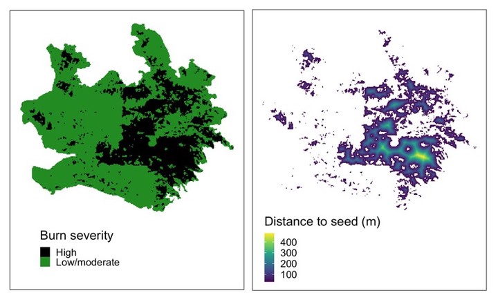
West of the Cascade Crest in Washington and Oregon (“northwestern Cascadia”), wildfire has historically been infrequent yet severe, occurring at intervals ranging from one to several centuries, with fire events possibly as large as one million hectares characterized by high levels of tree mortality. As climate continues to warm, some of the largest increases in area burned are expected to occur in regions such as northwestern Cascadia, where fire activity has historically been limited by cool, wet climate. Post-fire management strategies, such as replanting, can reduce the negative impacts of fire on forest ecosystems in this region. Developing post-fire response plans, however, requires an understanding of the spatial patterns of burn severity within fire events, since areas with high levels of tree mortality are where management intervention is often of greatest priority.
The objective of this research was to help managers better understand and prepare for wildfire in northwestern Cascadia. Using satellite data dating back to 1985, this project characterized how spatial patterns of burn severity, and thus fire impacts and forest regeneration needs, vary with the size of fire events in northwestern Cascadia. The results of this research provide key insights that will help land managers in this region develop strategies for adapting to a warmer, drier future that is likely to bring more frequent fire events.
Michele S. Buonanduci
Postdoctoral Researcher
My research interests include spatial analysis, landscape ecology, and forest ecology.